ถนนถนนช้างม่อย
ปะตู๋ถูกฮื้อเปื้อหื้อถนนนี้ไปตรงเถิงแม่น้ำ
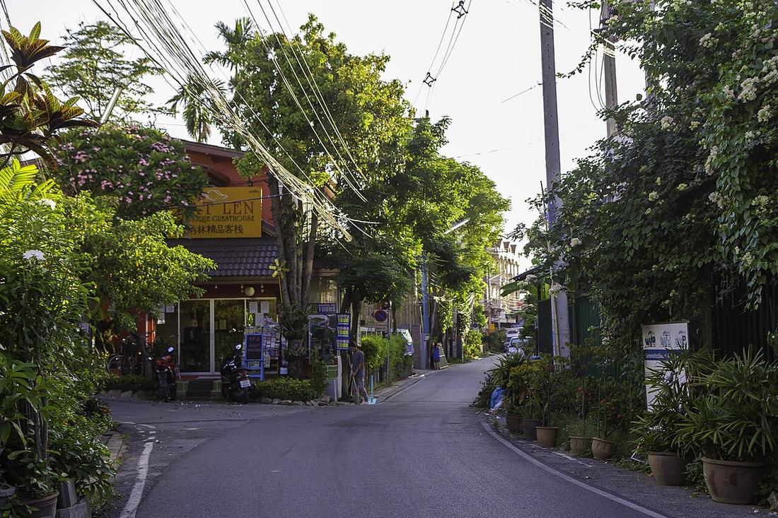 Stefan Fussan · CC BY-SA 3.0
1910–15เปิด
จาก แยกช้างม่อย ถึง แม่น้ำปิง
18.7930, 99.0000 · OpenStreetMap · แผนที่
คืออะไร
จากด้านตะวันออกเฉียงเหนือของกำแพง ข้างถนนวิชยานนท์ ถึงแม่ปิง ระหว่างปี 2453–2458 ประตูชั้นนอกและคันดินถูกรื้อ และกำแพงชั้นในถูกเจาะ เพื่อให้ถนนราชวิถีในเวียงวิ่งตรงต่อมาได้ ราคาประเมินปี 2559–62 ตารางวาละ 180,000 บาท สูงเป็นอันดับสี่ของเมือง
เกี่ยวข้องกับ
- ประตูช้างม่อย What was demolished for it.
- กาด Kad Luang is at its end.
ถูกอ้างถึงโดย
- ประตูช้างม่อย The road it was removed for.
- แผนที่เมือง 2433 The road it dates.
แต่ละข้อความมาจากไหน
| Field | Tier | Source | Note |
|---|---|---|---|
| default | cited | ถนนช้างม่อย — Wikipedia (th) | |
| text_th | inference | written in Thai by this project, in the northern register where it fits; not machine-translated |
แหล่งอ้างอิง
- ถนนช้างม่อย — Wikipedia (th)
cited Cited — a named source, linked · harvested Harvested — fetched from an open dataset, with its licence · tradition Tradition — general knowledge of the tradition, hedged · inference Inference — this project's own reasoning from the above · field Field — someone stood there